0
0
0
          BELLINGHAM FARMERS ELEVATOR  


Starting June 1st, we are offering Free DP on corn with a price deadline of July 30th.

Starting January 14, 2026 we are offering Free DP on soybeans.  This program will have a hard pricing date of July 30, 2026.

***We now can offer Premium Gasoline delivered to on farm storage***
 

Regular Hours:

8:00am - 4:30pm Monday - Friday
Saturday & Sunday:  Closed
Hours are subject to change

Bellingham Grain 320-568-2127
Bellingham Agronomy  320-568-2126 or 2216
Louisburg Grain  320-568-2453


    LP Tank Monitoring Information

If you have the tank monitoring equipment and would like to get notifications or App access please contract the Energy Department at 320-568-2126
You can start by download the App in your app store - type:  NEE-VO


On grower 360 you can now pay your bills online! Automatically taken out of your checking account is free and credit card payments there will be a 3% charge. Any questions please call the office and we can help you set it up.
 

We now offer online access to your account activity such as invoices, statements, scale tickets, etc.  To get your account activated please call 320-568-2127 and Brenda or Erin will set it up.  The online portal is called grower360 and can be found at  https://bfe.grower360.net/sign-in
This link needs to be opened in google chrome.


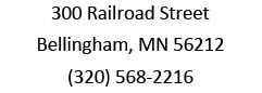
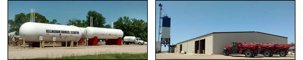
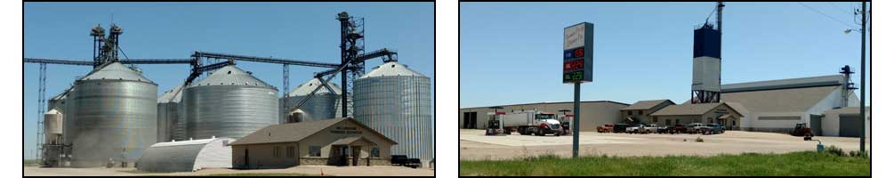
    Thank you for checking out our website!
 Full service Cooperative with Agronomy, Grain, Feed & Petroleum!


NEWS
 

NYMEX Quotes
LINK TO NYMEX ENERGY

DTN Ag Headline News
US Pasture Conditions Improving
USDA Weekly Crop Progress Report
USDA Reports 2 More Texas NWS Cases
Top 5 Things to Watch
View From the Cab
Trump Suggests New Payments to Farmers
Rural Resilience - 9
CHS to Close or Sell 3 Grain Elevators
DTN Retail Fertilizer Trends

Add Us To Your Favorites
 
Follow the steps below to add http://www.bellinghamfarmerscoop.com to your bookmarks.
  • Open the Communicator menu.
  • Choose Bookmarks.
  • Choose Add Bookmark.


DTN Ag Headline News
US Pasture Conditions Improving
USDA Weekly Crop Progress Report
USDA Reports 2 More Texas NWS Cases
Top 5 Things to Watch
View From the Cab
Trump Suggests New Payments to Farmers
Rural Resilience - 9
CHS to Close or Sell 3 Grain Elevators
DTN Retail Fertilizer Trends

DTN/PF Renewable Fuels
Latest DTN/PF Renewable Fuels News
Wednesday, April 8, 2026 10:29AM CDT
Ethanol production in the United States averaged 1.116 million barrels per day (bpd) in the week ended April 3.

Wednesday, May 20, 2026 10:02AM CDT


DTN Cash Bid Updates
Log in
Username:
Password:
Click Here to request a username/password.


MARKETS
 

Futures
@C - CORN - CBOT
Month Open High Low Last Change Close Time More
Jul 26 419'0 421'0 418'2 419'6 1'0 418'6 01:19A Chart for @C6N Options for @C6N
Sep 26 427'4 429'4 427'0 428'4 1'0 427'4 01:19A Chart for @C6U Options for @C6U
Dec 26 446'2 448'0 445'4 446'6 0'6 446'0 01:19A Chart for @C6Z Options for @C6Z
Mar 27 460'6 462'4 460'4 461'2 0'4 460'6 01:19A Chart for @C7H Options for @C7H
May 27 469'2 471'0 469'2 470'0 0'4 469'4 01:19A Chart for @C7K Options for @C7K
Jul 27 475'0 476'6 475'0 475'4 0'2 475'2 01:19A Chart for @C7N Options for @C7N
Sep 27 470'0 470'0 469'6 469'6 0'6 469'0 01:18A Chart for @C7U Options for @C7U
Dec 27 477'0 478'2 476'2 476'4 -0'4 477'0 01:18A Chart for @C7Z Options for @C7Z
@S - SOYBEANS - CBOT
Month Open High Low Last Change Close Time More
Jul 26 1116'2 1117'0 1111'0 1112'4 -3'2 1115'6 01:19A Chart for @S6N Options for @S6N
Aug 26 1121'6 1122'2 1116'6 1117'6 -3'4 1121'2 01:19A Chart for @S6Q Options for @S6Q
Sep 26 1120'2 1122'0 1117'4 1118'4 -2'0 1120'4 01:19A Chart for @S6U Options for @S6U
Nov 26 1135'4 1137'0 1132'0 1133'2 -2'2 1135'4 01:19A Chart for @S6X Options for @S6X
Jan 27 1150'0 1151'2 1146'6 1147'4 -2'4 1150'0 01:19A Chart for @S7F Options for @S7F
Mar 27 1156'6 1158'2 1153'6 1154'4 -2'4 1157'0 01:19A Chart for @S7H Options for @S7H
May 27 1164'4 1164'4 1161'2 1161'2 -3'2 1164'4 01:19A Chart for @S7K Options for @S7K
Jul 27 1171'4 1171'4 1168'2 1169'0 -2'0 1171'0 01:19A Chart for @S7N Options for @S7N
@MW - HARD RED SPRING WHEAT MPLS - MGE
Month Open High Low Last Change Close Time More
Jul 26 6.1750 6.1950 6.1750 6.1850 -0.0100 6.1950 01:12A Chart for @MW6N Options for @MW6N
Sep 26 6.4400 6.4550 6.4375 6.4550 0.0050 6.4500 01:12A Chart for @MW6U Options for @MW6U
Dec 26 6.6725 6.6725 6.6600 6.6675 0.0025 6.6650 12:50A Chart for @MW6Z Options for @MW6Z
Mar 27 6.8500 6.8500 6.8300 6.8350 -0.0150 6.8500 06/08 Chart for @MW7H Options for @MW7H
May 27 6.8950 6.8950 6.8950 6.8950 -0.0500 6.9450 06/08 Chart for @MW7K Options for @MW7K
@LE - LIVE CATTLE - CME
Month Open High Low Last Change Close Time More
Jun 26 250.000 251.250 245.550 246.050 - 3.550 246.525s 06/08 Chart for @LE6M Options for @LE6M
Aug 26 241.650 243.250 236.250 236.325 - 4.925 236.725s 06/08 Chart for @LE6Q Options for @LE6Q
Oct 26 234.175 236.150 228.925 228.975 - 4.775 229.350s 06/08 Chart for @LE6V Options for @LE6V
Dec 26 233.700 235.725 228.850 229.300 - 4.100 229.575s 06/08 Chart for @LE6Z Options for @LE6Z
Feb 27 234.225 235.925 229.450 230.200 - 3.600 230.400s 06/08 Chart for @LE7G Options for @LE7G
My Custom Markets
Symbol Open High Low Last Change Close Time More

 
CLICK HERE FOR US DOLLAR INDEX AND BRENT CRUDE FUTURES
 

Intraday Commodities
@CN6


WEATHER
 

Local Conditions
Bellingham, MN
Chg Zip Code: 
Temp: 75oF Feels Like: 77oF
Humid: 89% Dew Pt: 72oF
Barom: 29.92 Wind Dir: SE
Cond: N/A Wind Spd: 7 mph
Sunrise: 5:37 Sunset: 9:12
As reported at ORTONVILLE, MN at 1:00 AM
View complete Local Weather

Local Radar
Bellingham, MN
Chg Zip Code: 
 
Radar
View complete Local Weather

5-day Forecast for Bellingham, MN
Change Zip Code: 
Date Tue
6/9
Wed
6/10
Thu
6/11
Fri
6/12
Sat
6/13
Weather
Condition
Thunder Storms Thunder Storms Rain Partly Cloudy Mostly Cloudy
Weather Thunder Storms Thunder Storms Rain Partly Cloudy Mostly Cloudy
Temp
L/H (°F)
66/90 64/80 60/73 57/77 54/73
Feels
Like

L/H (°F)
66/94 64/81 60/73 57/77 54/73
Dew Point
(°F)
68 61 50 50 48
Humidity
(%)
61 59 50 46 48
Wind
Speed

(mph)
14 15 16 16 13
Precip
(%)
40 60 63 - -
Precip
Amt
(in.)
Rain
0.24
Rain
0.29
Rain
0.12
None None
Evap
(in./day)
0.25 0.23 0.24 0.27 0.22
View complete Local Weather

Member Login


Copyright DTN. All rights reserved. Disclaimer.
Powered By DTN